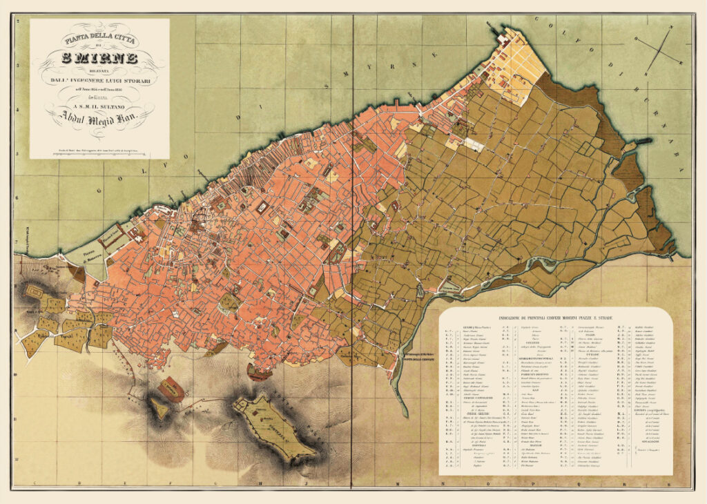
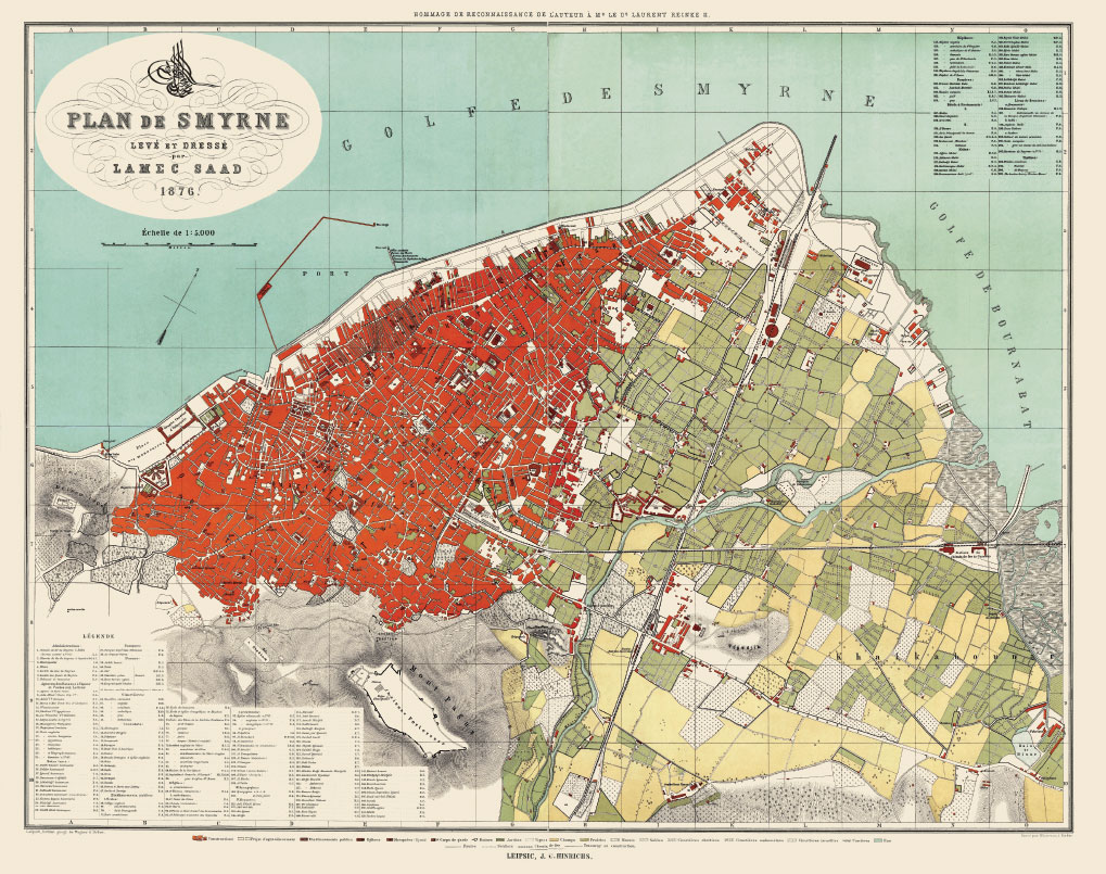
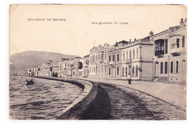
With the completion of the quay construction, which began in 1869 and was largely finished by 1875, İzmir not only gained a modern port infrastructure but also acquired a promenade. This development resulted from the regulation of the 4-kilometer-long stretch extending from the customs building (now Konak Pier) to Punta Burnu(now Alsancak Port), forming what is known today as Kordon.
From the 17th century onwards, as İzmir-centered trade began to flourish, the number of European merchants settling in the city steadily increased. These merchants, known as Levantines, primarily resided along the Kordon Promenade, and this area became known as the “Frank Quarter.” Before the construction of the quay, the coastline was irregular, with trading houses belonging to merchants of different nationalities situated along its length. Ships arriving from Europe would dock at the private piers of these trading houses, unload their cargo, and take on new goods to transport back to Europe. The structures in this area were designed so that their seaward-facing side housed commercial establishments, while their landward-facing side contained the residences of European merchants. Thus, until the emergence of Kordon, this area served as a commercial hub and a residential district for European traders.
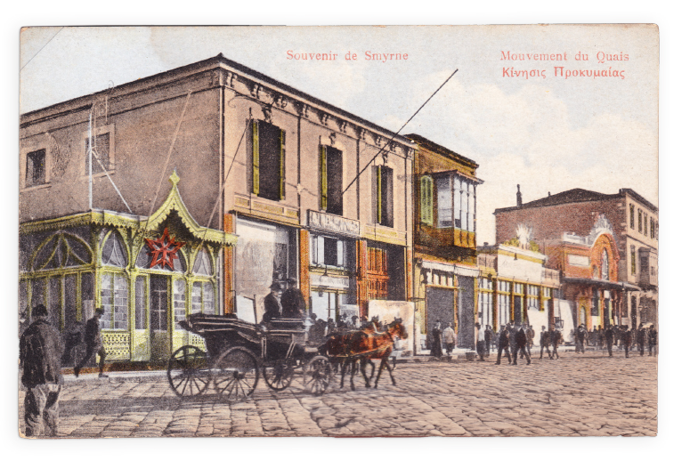
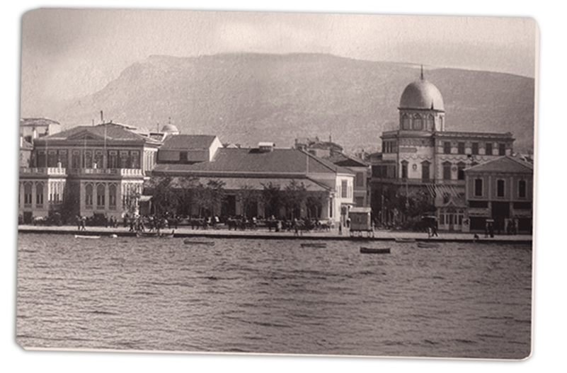
With the formation of Kordon Promenade, numerous new buildings were constructed on the reclaimed land from the sea. Among these buildings, hotels, entertainment venues, theaters, and cinemas constituted the majority. Additionally, a small number of commercial buildings and official structures also found their place in this area. In this context, Kordon emerged as a new public space where both the city’s residents and visitors could fulfill their needs for relaxation, leisure, culture, arts, and entertainment. Prof. Dr. Emel Kayın, who has conducted significant research on the place of Kordon Promenade in the city’s history and identity, describes life here based on contemporary sources as follows:
“This world, which generally consisted of Europeans and non-Muslim minorities [referring to the first period of Kordon Promenade until 1922], is depicted in period sources with vibrant imagery. In addition to commercial hustle and bustle, well-dressed individuals were sitting in cafés, balls, receptions, and the music of variety shows; the celebration of national holidays by foreign countries, the movement of ships in the harbor, and the illuminated quay on special occasions.”
Following the liberation of İzmir from Greek occupation, the Great İzmir Fire broke out, devastating much of the buildings along the Kordon and rendering them unusable. In the period that began with the proclamation of the Republic, Kordon continued its public identity centered around strolling, dining, and entertainment activities. However, it lost its multicultural and vibrant character compared to its previous era.
The most significant transformation of Kordon Promenade began in the 1960s with the demolition of two- and three-story buildings and the construction of seven- and eight-story apartment buildings in their place. During these years, Kordon became more of a residential area. Despite weakening its public identity centered around strolling, dining, and entertainment compared to previous periods, it persisted with the cafés and restaurants that opened on the ground floors of the apartment buildings.
In the Master Zoning Plan for the İzmir Metropolitan Area, approved by the Ministry of Public Works and Settlement in 1973, it was envisioned that the coastline stretching from Inciralti to Bostanli would be extended by land reclamation up to 250-300 meters to create new public spaces that would accommodate the city’s future needs arising from its development. Within this scope, in the early 1990s, a project was proposed to reclaim land at Kordon Promenade and construct a new highway in the newly acquired area. However, while the reclamation process was ongoing, the matter was brought to court, and the zoning plan permitting the construction of the highway was annulled. Nevertheless, during this period, the land reclamation was completed, and the newly created area was transformed into a recreational space by the İzmir Metropolitan Municipality and opened for public use.
With the latest modifications, a significant transformation has taken place in the public character of Kordon Promenade. In its new form, Kordon has become a public space where people walk by the sea, sit on the grass to spend time, go for walks or runs, and ride bicycles. Although restaurants and cafés still occupy the ground floors of the apartment buildings, their separation from the sea has significantly altered the nature of their dining and entertainment functions compared to the past.
Spanning nearly 150 years from its emergence to the present day, Kordon Promenade, an essential part of the city’s skyline, also stands as both a witness to and a summary of the city’s transformations has undergone during this period.